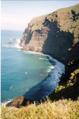
The coastline of La Palma is rough, no doubt about that.
But there are a few small beaches around, and in Puntagorda
where we stayed, we found a very special one.
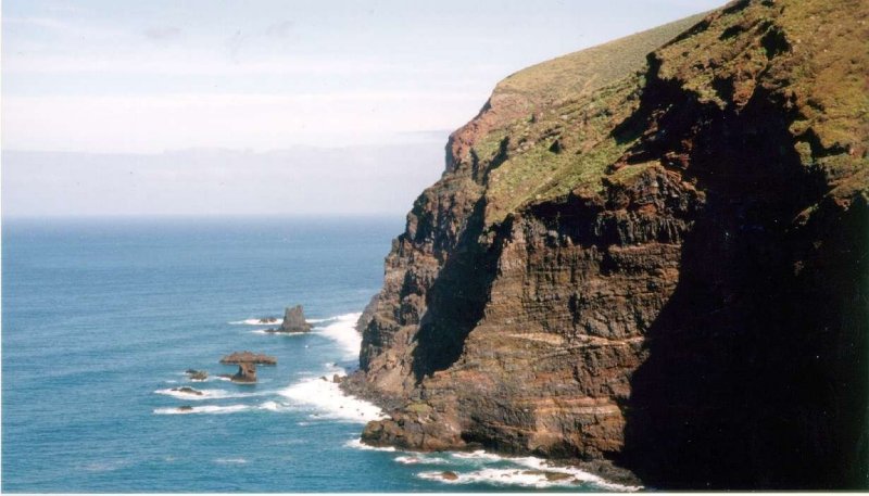
Punta
de las Llanadas (see 1 on map below)
Picture was taken from 2.
There was quite a bit to walk, but
as mentioned other places on this web-site,
we love walking. As shown on the map below, we started from the
upper
right corner, and down a small path, then back while climbing down
one of
the many 'baranque's, and up on the other side again and out to
the main road.
Around a lot of curves and down from 600 m asl to 400 m asl.
Not there yet (no seawater at 400 m asl), and in all we had to walk
about 7-8 kilometers to reach the 'beach'.
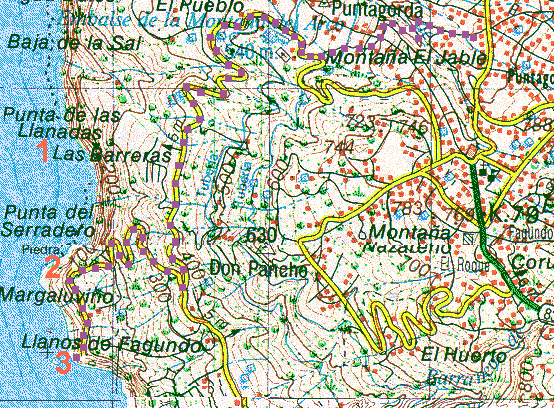
Route
from our house in Puntagorda, all the way down to the 'beach' (3).
Looking closely you will see that the coastline northwards goes
stright up
to the 200m asl level. That is quite normal on the coast of La Palma.
Now from the point where we were
down at 400 m asl, another road took off
and leads down to the 100 m asl. At this point we could see the
road
going back and forth - or from right to left and back again, curving
down
the hillside. The point where the road disappers over the edge up
in the left corner
in the picture below is marked with number 2 on the map above,
and it looks just like that...
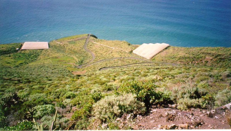
The
road down to the beach, picture taken from about 400 m asl level,
down to point 2 on the map above.
From
there there are just a few hundred meters to the end of the road.
Right there where it ends, the level above the sea was estimated
to 78 m
by a cyclist we met. From here you have to start climbing down
all 450 - fourhundredandfifty - steps that someone built somehow
in the mountainwall. From here we could also look down
to what might be our goal even as it didn't look like a 'beach'.
Looking
down from the end of the road. You can even see some of the steps
down in the left haft part of the picture. Also there are some strange
white
squares to be seen - more in the next two pictures.
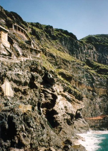
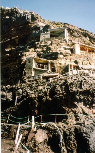
Believe
it or not, but the locals have found some old caves in the mountainside,
perhaps remainings after the historic pirates that used to visit
the island several
hundred years ago. And here they have built walls on the outside,
putting in
windows, and set up TV-antennas and panels of cells changing sunlight
to
electricity. (What do you call that in english?)
And of course the pipes with water was criss-crossing all over the
hillside.
Alltogether we found it to be some 55 small 'homes' or
may be they are summer-residents?
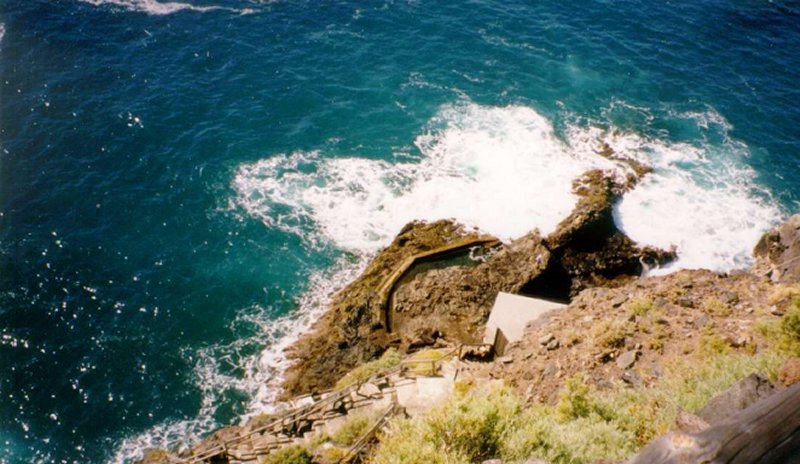
Then
came the best part. Back in the 18th century it is said that a count
who loved
his wife very much, built this swimmingpool to her. Wether he also
took the job with
the 450 steps I don't know, but he must have been a nice man...
If
you once again look at the picture above the two of the 'summer'residents'
you will se the rocks way out in the sea. They are right behind
on this picture.
From there he built a channel leading the seawater that all the
time hits the
outer of the rocks into the pool behind the wall to the right.
It is about 5 x 4 meters and just about 1 meter deep, but with nicely
sunheated water which we believe to have a temperature near the
25°C point.
Another feature with this pool was that a lot of small fish also
had found
their way into the pool, so you didn't have to feel lonesome in
there...
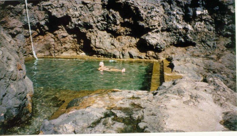
Water
coming in down in the left corner, and when too much water
it found its way out again to the right. Not bad for a countess?
And
where else would she have been able to swim on this coastline?