Tongkoko is a statovolcano, and rises 1.149 m asl in position 1.52°
N and 125.20° E.
Tongkoko is the Nord-Eastern most volcano on the island of Sulawesi.
The slightly higher Dua Saudara stratovolcano is located only 3 km
to the SW of Tongkoko, and along with Tongkoko, forms the most prominent
features of Gunung Dua Saudara National Park, a noted wildlife preserve.
Eruptions occurred from the summit crater of Tongkoko in the 17th
century and in 1801.
The prominent, flat-topped lava dome Batu Angus originated on the
E flank of Tongkoko
in 1801, and, along with an adjacent E-flank vent, has been the source
of all
subsequent eruptions.
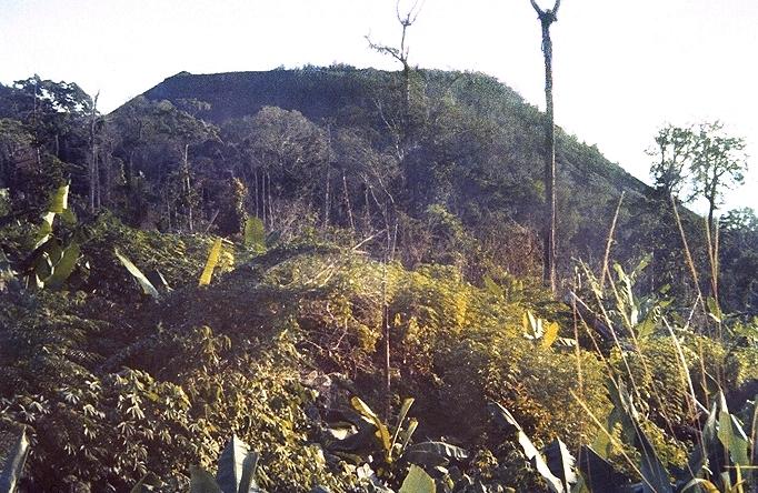
The
flat-topped Batu Angus lava dome formed on the east flank of Tongkoko
volcano
during an eruption in 1801. A lava flow traveled 2 km down the flank.
November 7th, 2002
An increase in the number of volcanic earthquakes at Tongkoko since
24 October led VSI
to raise the Alert Level from 1 to 2. The number of deep volcanic
earthquakes decreased in comparison to the previous week. VSI reported
that the increased number of shallow volcanic earthquakes indicated
that seismicity was migrating to the surface.
|
Latest news always on top. Below
are older incidents.
|

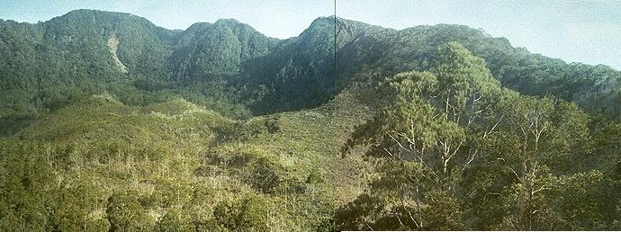
Tongkoko
vvolcano, seen from Lembe island to the east.
The lava domeBatu Angus, which was formed during an eruption in 1801,
can be seen on the east flank in the center of the photo.
Eruptions have taken place, as far as we know, since
1680, when there probably were a fatal eruption, on VEI
5. Another two eruptions in 1683 and 1694 hit VEI 3 on that scale.
The eruption in 1801, which is far better known, only reached VEI 2,
but was both fatal,
deadly, explosive, and also formed a crater-lake.
Photo, and part
of text on this page:
Kimberly, P., Siebert, L., Luhr,
J.F., and Simkin, T. (1998). Volcanoes of Indonesia, v. 1.0 (CD-ROM).
Smithsonian Institution, Global Volcanism Program, Digital Information
Series, GVP-1.
Search this site - Søk våre sider
|
