|
Whether you like to go balancing on
the ridge of the mountain-chain,
or wandering up and down the hillsides - or just follow the paths
going
all over the island, La Palma is your destination.
We did make one attempt
to do the first, but as we show you further down
this page, we didn't exactly succeed. However, the landscape was
just excellent for our way of walking, as you will understand when
you join us on our pages here.
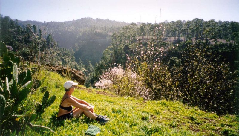
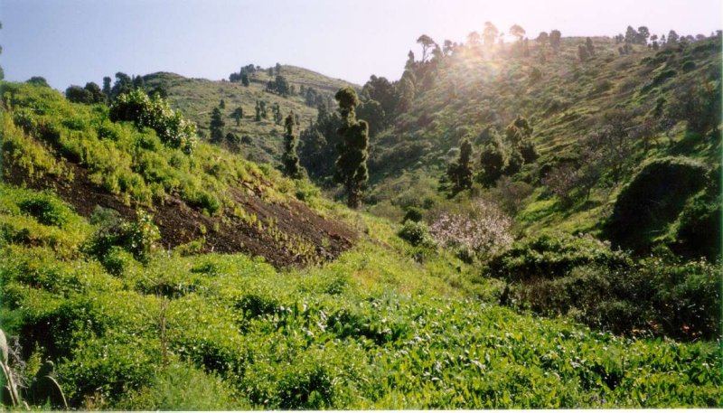
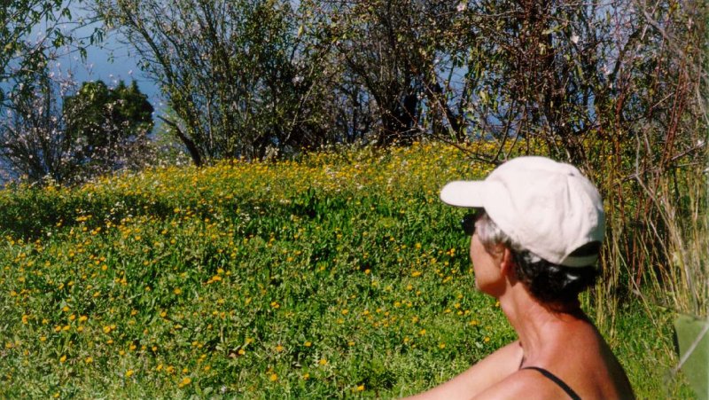
And most exciting at
this time of the year, is the all over flowering almonds,
not only in gardens or plantations. You never get tired sitting
down watching them - and the flowers - and the rest of the vegetation.
Isn't
it (she) beautiful?
Anyway,
we one day set off just to see how far up we could go
in one day - we did have plans going to the top some day, you see.
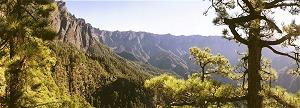
And off we went. Not too hot that day, but we learned a lot about
walking around on (up) La Palma. The pines were all around us, and
the path was well marked all the way. The rise in the terrain, however,
was nearly 25% in average, forcing me to tip-toe up the hill, and
that wasn't at all easy.
Thought
we had reached about 1.500 m asl when suddenly:
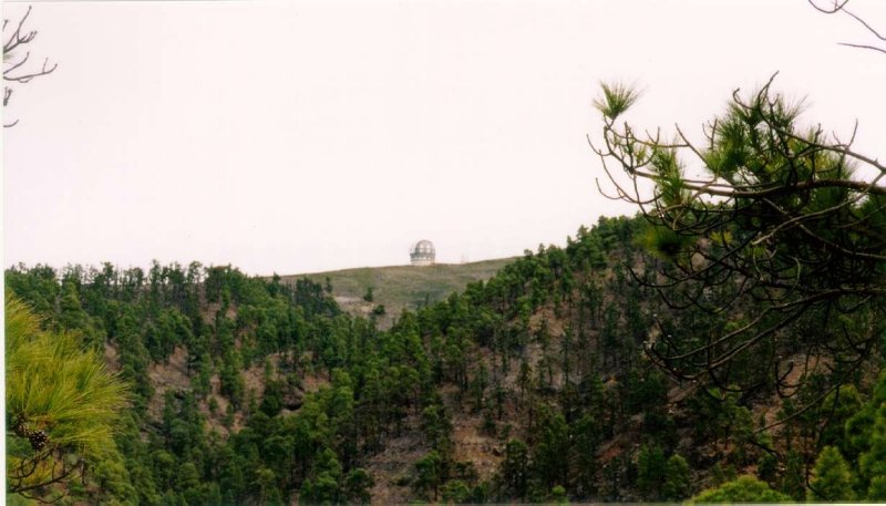
The
Observatory showed up in between the pines, and indeed
we were up about 2.100 m asl.
We had planned to turn back exactly
at 15.00 hours, and later changed it to 14.45 as we had to admit that
that
would be enought for to-day. But seeing the Observatory there right
ahead
of us, we once again changed to 15.00, and went up another few meters
asl.
Why return at a certain
hour? Well, as we have told before, darkness
comes suddenly right after sundown, and if we had to be caught somewhere
up
in the pinewoods, there were at least 3 good reasons for not being
so:
1. You couln't find
the path in the dark
2. You couldn't even
find a secure way down to any light
way down the hill.
3. You would just have
to sit down and wait till the cold came creeping,
with temperataures down to 5°C or less - don't know what it would
be up there -
but down in our "casa" it had ranged from 7° to 11°C
during night-time.
None of us was specially
fond of that, so that's why we agreed upon turning back,
whatsover to show up further ahead (upwards), at 15.00 hours.
And so we did.
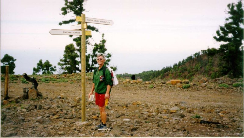
However, we managed to make some few
hundred meters before the
time run out, and there we found a crossroad, telling us where we
were.
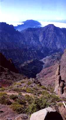
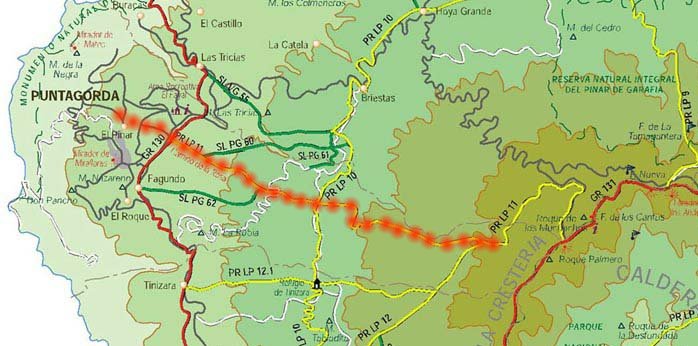
To the right it showed to "Puntagorda", from wehre we came.
To the left
it pointed towards the highest mountain, Roques de los Muchachos.
The third sign, showed the route down the westernly slop of the
Caldera de Tamburiente, towards "Torre del Time", just above
the valley
of Los Llanos de Aridane.
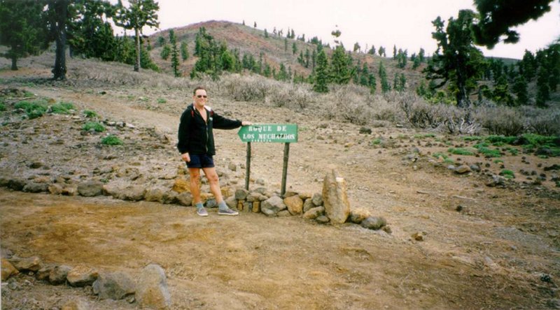
Just to be sure we were where we were
(is that good english spoken?),
we had to look at the next sign, too. That one led only up to the
top
of the Island, to Roque de los Muchachos.
Why we didn't try to
reach the top at a later date? Well, when you
are aged somewhere in the 60's, you just have to accept that you
are not as young as you would like to be, although your wife is
still running up the hill like a gazelle.
Another reason for
not doing so, you will see from the following table:
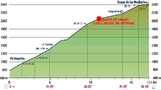
We set off at 680 m asl, and went along for 4 hours. To reach the
top it
would have taken us 6 hours at least, and then another 5 to get back.
Since there is no daylight before 8 AM and the darkness comes at
19 in the evening, that leaves no time at all, if we would not be
able
to keep the schedule. So till next time....
 
|